|
|
|
Geography Project
<insert name pls>
When the volcano ‘
Soufriere Hills’ on the Caribbean Island of Montserrat erupted in 1995, the whole world, especially the residents of the island, were in complete shock. Below is a picture of the location of Montserrat in relation to the rest of the Caribbean: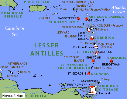
Montserrat
It caused the entire population on the ‘South Side’ of the island to evacuate their homes and flee their businesses in a massive escape to the North Side of the island where they took refuge from the lava and rocks being hurled out of the volcano, ‘
Soufriere Hills’, like bullets from a gun. The eruptions were small but plentiful in amount and they hurled out mainly ash, dust and lava. This is the report of one eyewitness at the seen of the first eruption: ‘I don’t know what happened. We heard this rumbling and then we came out of the shop where my wife and I work and all this lava and rubble was rolling down the side of the mountain towards us. People were shouting and screaming and we got our children, some possessions and then got in our car and followed all the people leaving the area. I assumed they were heading for the North because that is will never forget. Our shop was completely destroyed when we returned home several months later, there was nothing where it used to stand.’To make matters worse… After the island had been evacuated and the people who had once lived there so peacefully were preparing to move back to what was left of their homes in 1997, disaster struck. A subsequent eruption, also from
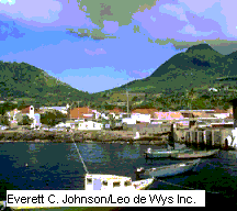
Soufriere Hills, partially burnt the deserted town of Plymouth. Below is a comparison of Plymouth, before the eruption in 1995 and after the eruption in 1997:Before:
After:

The island, 102 sq. km (39-sq. mi) in area, is volcanic in origin and mountainous. The highest point is Chances Peak (915 m/3,000 ft) located in the south in the Soufriere Hills, which have fumaroles (gas and steam vents) and other evidence of active volcanism. In July 1995, after several millennia of dormancy, the Soufriere Hills Volcano to the east of Chances Peak became active again. Subsequent eruptions of ash, steam, and magma led to fears of major explosive eruptions and forced the evacuation of the south of the island. By March 1997 a new dome had been built up, reaching some 940 m (3,084 ft) above sea level, and in June 1997 the volcano erupted in ‘nuées ardentes’ (pyroclastic flows) in which dust, rock, and gas are ejected at temperatures of up to 550° C (1,000° F) and at speeds of up to 320 km/h (200 mph).
Comparison
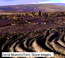
Although the south side of the island of Montserrat, the place where the eruption took place, is a poor area… It is still a built-up area and a successful port. Therefore, for this comparison, I shall compare it to the effects of a volcano on an area of little to no population, Hawaii Volcanoes National Park in Hawaii, an island in the Pacific Ocean and one of the 50 American States. The park established in 1916 and covers 927.4 sq. km (358.1-sq. mi). It contains two active volcanoes, Mauna Loa and Kilauea. Mauna Loa, the world's largest volcanic mass, towers 4,169 m (13,677 ft) above sea level. The walls of its summit crater, Mokuaweoweo, rise to about 180 m (600 ft); eruptions occur here and from the fissures and newer craters that have formed on the slopes of the mountain. Kilauea projects from the eastern slope of Mauna Loa; it rises 1,111 m (3,646 ft) above sea level. The east rift of Kilauea has been erupting continuously for more than 10 years. Kilauea's crater, with an area of more than 10 sq km (4-sq mi), is the largest active volcanic crater in the world. Its vast inner pit, Halemaumau, is sometimes called the "House of Everlasting Fire." The park's varied landscape includes the Kau Desert on the arid leeward (eastern) slope of Kilauea and a luxuriant tree fern forest on its moist windward (western) slope. Hawaii Volcano Observatory (established 1911) is on the rim of Kilauea Crater. Until 1961, Hawaii Volcanoes National Park was combined with Haleakala National Park on Maui Island as Hawaii National Park. As no one lives near the places of eruption, there are no consequences. Eruptions happen regularly but don’t kill or affect anyone because there is no one there to effect. Below is a picture of the volcanic plains in Hawaii:
What can be Done?
To make sure that no one is harmed in future volcanoes, measures should be taken to make sure that they are forecast in advance as far as possible so that people know when they are imminent and can take the necessary precautions, ie. Evacuate their homes and gather their possessions etc. Also, if a system whereby the lava/ash/dust/magma is stopped and caught in some way before it gets near the ground, then there would be hardly any casualties and less damage.